
The Best Fall Colors Around Salt Lake City: Easy Drives, Pull-offs, and Quick Wins

Salt Lake City does fall fast. High slopes flip first, then the benches, then the parks. If you’ve only got a weekend, you can see a lot without lacing up boots. The trick is stacking short canyon drives, one or two scenic loops, and a few in-town parks that save the day when your schedule gets tight. This guide keeps it simple, geo-friendly, and visitor-proof.
Quick Timing Cheat Sheet
High country: late September into early October.
Mid elevations and benches: early to mid October.
City parks: mid to late October, sometimes longer if the weather behaves.
Storm rule: a single cold snap or wind event can strip exposed ridges in 24–48 hours. Keep a lower-elevation backup.
Why Utah’s Color Pops
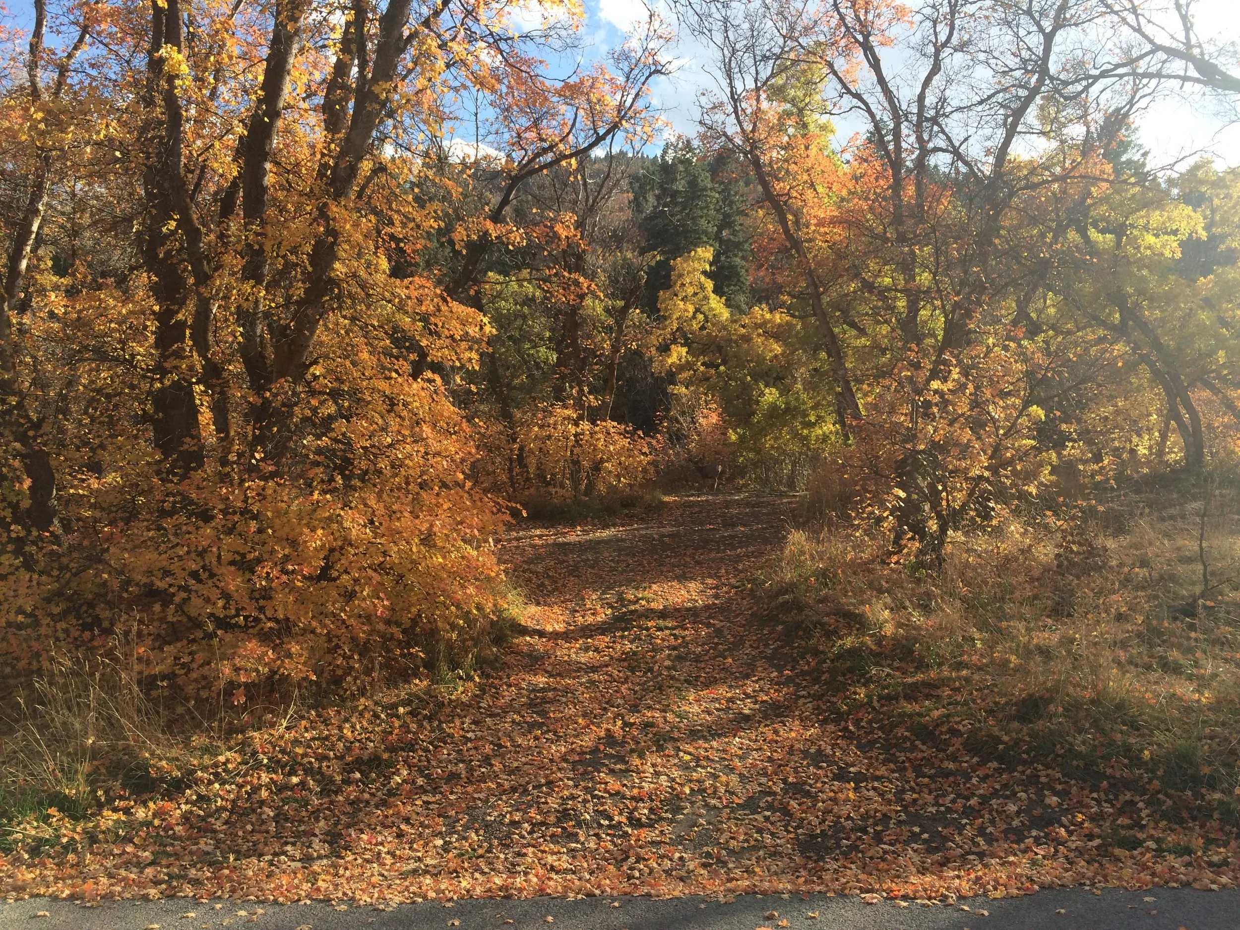
Bigtooth maple brings the reds and oranges on sunny foothills.
Gambel oak adds bronze and rust across huge swaths of hillside.
Quaking aspen flips electric gold at higher elevations and cool drainages.
Cottonwoods carry late yellow along creeks and valley parks.
Aspect matters: north-facing slopes and shaded benches often hold color longer.
Elevation stacks the show: start high, slide lower as the season moves.
Road Smarts in One Minute
Start early. Canyons shade out fast in the afternoon.
Pull fully into signed turnouts and keep wheels off travel lanes.
Pack layers. It can be 70°F in town and 40°F at a pass.
Check seasonal roads after any storm. High passes close first.
Bring water, snacks, and a full tank. Cell service is hit-or-miss in the high country.
Weekdays are quieter. Weekends need earlier starts and more patience.
The Shortlist: 10 Places That Deliver
1) Big Cottonwood Canyon (SR-190) → Optional Guardsman Pass Loop
Distance from downtown: about 30–40 minutes to the top without stops
Vibe: granite drama down low, alpine calm up high, color the whole way
Why people love it:
Immediate color at the canyon mouth, then increasingly alpine toward Brighton.
Silver Lake boardwalk is a zero-effort win with mirror water on calm mornings.
When open, Guardsman Pass makes a great loop to Park City and back.
Pull-off ideas:
Storm Mountain area for big cliffs and maple foregrounds.
Mill B South pullout for quick color without committing to a long hike.
Silver Lake for a flat lap surrounded by aspen.
Photography notes:
Best light: morning for east faces; late light glows in the upper bowls.
Bring a polarizer to cut glare on leaves and water.
Trees you’ll see:
Lower: Gambel oak + bigtooth maple = rusty reds and oranges.
Upper: bands of gold aspen near the ski terrain.
2) Little Cottonwood Canyon (SR-210) + Tram Views
Distance from downtown: around 35–40 minutes to the resorts
Vibe: narrower canyon, towering granite, concentrated color pockets
What to do:
Park once at Snowbird. Wander the plazas for creekside color. Ride the tram for a bird’s-eye view of gold bands against dark conifers.
Continue to Alta for high-alpine bowls and ridge lines.
Why it’s different:
The granite walls are taller and closer, so the light drops early.
Pockets of color feel dramatic against the stone.
Trees you’ll see:
Aspen up high, maple and oak mid-canyon, cottonwoods along the creek.
3) Millcreek Canyon
Distance from downtown: about 25 minutes
Vibe: close, leafy, mellow, with tons of picnic pullouts
Why go:
“Tunnel of trees” sections put you inside the canopy.
Easy stops near Elbow Fork, Terraces, and Upper Millcreek.
Dog rules vary by day; read the sign at the fee booth and plan accordingly.
Trees you’ll see:
Oak and maple in lower and middle sections.
Aspen pockets higher up the canyon.
Good progression from valley to ridge, so you can chase peak bands.
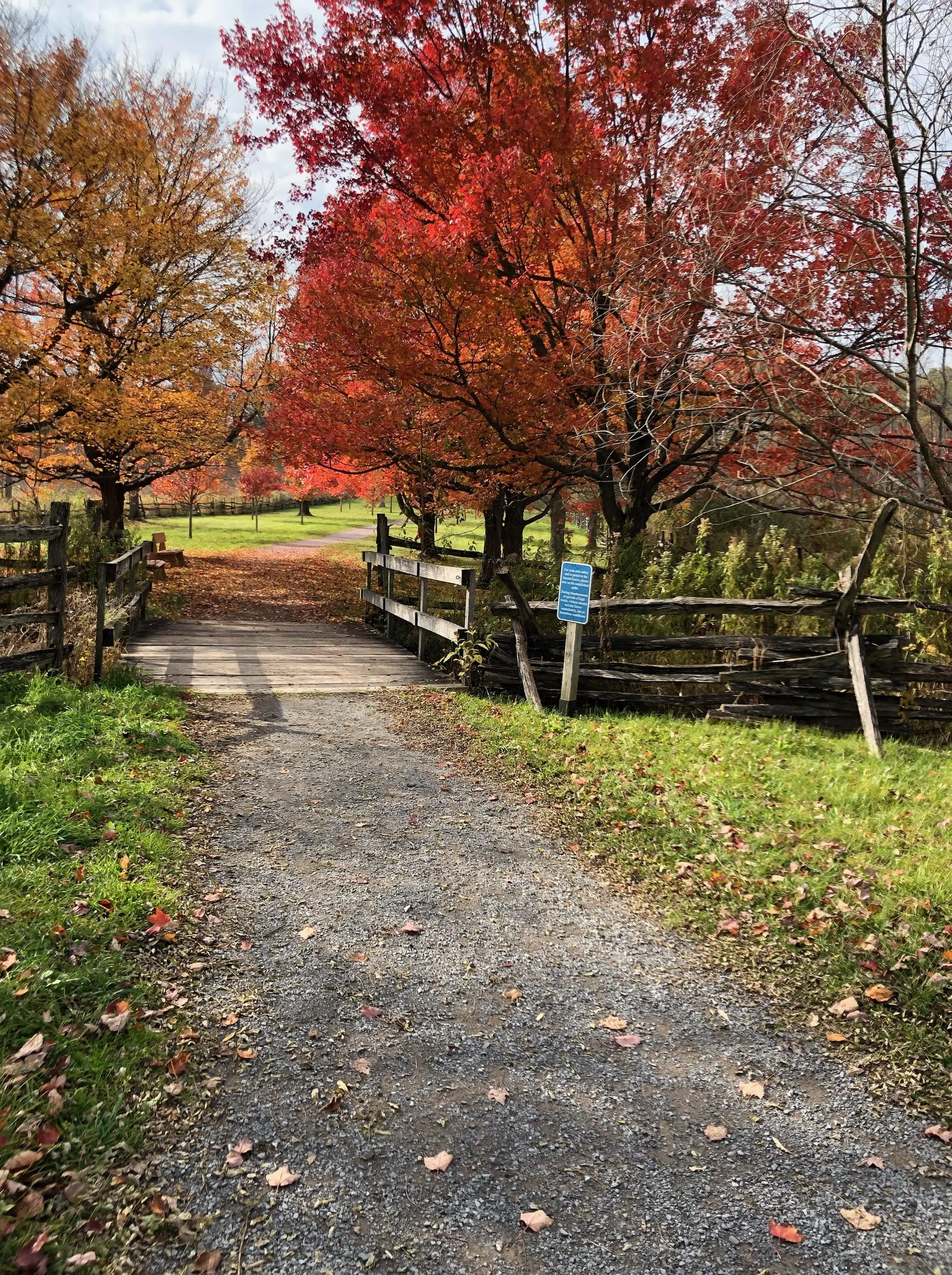
4) City Creek Canyon + Memory Grove
Distance from the State Capitol: basically behind it
Vibe: instant nature without leaving downtown
How to do it:
Start in Memory Grove for big shade trees, lawns, and stone memorials.
Walk or drive up City Creek Canyon for foothill color and a running creek soundtrack.
The paved road has alternating use days for bikes and cars during the main season; check the gate sign.
Why it works:
You can sneak a leaf walk between meetings or after dinner.
Early and late light is pretty, and the creek reflects color on calm days.
Trees you’ll see:
Mature city hardwoods in the park, then oak and maple on the hillsides.
5) Emigration Canyon → Big Mountain Pass (SR-65) → East Canyon Loop
Distance: 1.5–2.5 hours round-trip with stops
Vibe: history + color + broad views
Route play:
Climb Emigration Canyon to Little Dell.
Turn onto SR-65 over Big Mountain Pass.
Drop to East Canyon and loop home via I-80.
Why it’s special:
You’re tracing the pioneer route into the valley.
Sunny hillsides explode with maple and oak.
The pass overlook gives you a wall-to-wall ridgeline panorama.
Heads-up:
This is a seasonal mountain road. If a storm hits, it can shut early for the year.
6) Alpine Loop Scenic Byway (SR-92) + Cascade Springs Spur
Distance from SLC: plan 60–75 minutes to the start
Vibe: tight curves, cathedral trees, huge mountain backdrops
How to do it:
Enter via American Fork Canyon and follow SR-92 under Mount Timpanogos.
Add the Cascade Springs spur for boardwalks over clear pools and cascades.
Why it’s an all-timer:
Red maples drape right over the road.
Golden aspens near the crest.
Plenty of pullouts to reset, breathe, and shoot.
Driving note:
The spur is narrow and winding. Take it slow and enjoy the views.
SR-92 is seasonal. If the forecast wobbles, go sooner.
7) Mirror Lake Scenic Byway (SR-150) to Bald Mountain Pass
Distance from SLC: 75–90 minutes to Kamas, then up
Vibe: big-sky alpine with glittering lakes and a true high pass
Stops that hit:
Provo River Falls for whitewater and color in the willows.
Bald Mountain Pass for the highest paved road point in Utah.
Pullouts around Mirror Lake for reflections when the wind settles.
Expect:
Cooler temps and an earlier season than the Wasatch front.
Day-use fee areas near the lakes and major trailheads.
A seasonal highway that can shut with the first big storm.
Trees you’ll see:
Huge aspen drifts below the pass.
Willows and shrubs around shorelines, gold against blue water.
Sparse, wind-sculpted trees near and above treeline.
8) Park City Backroads + Wasatch Mountain State Park
Distance from SLC: 40–60 minutes depending on route
Vibe: ski-town hillsides, chairlift lines cutting through golden bowls
How to roam:
Crest via I-80 or Guardsman Pass if it’s still open.
Loop the side valleys, then drop to Midway and Heber for pastoral scenes.
Add Wasatch Mountain State Park for easy color along roads and short paths.
Why it’s nice:
Easy parking, food, and restrooms.
North-facing bowls often hold color longer.
Roads twist through aspen stands at friendly photo distances.
9) Red Butte Garden, Liberty Park, and Sugar House Park
Distance: all inside the city grid
Vibe: lunch-break color and family-friendly strolls
Why each works:
Red Butte Garden sits on the foothills with curated plantings that change week by week.
Liberty Park is lined with mature hardwoods and late-season glow.
Sugar House Park frames Mount Olympus for those postcard layers.
What to expect:
Flat paths, lawns, picnic tables, and plenty of space.
Ideal when the canyons cloud over or you only have an hour.
10) Bonus Day Trips if You Have Extra Time
Provo Canyon to Bridal Veil Falls and the benches above Orem: big cliff walls and late-day color.
Nebo Loop Scenic Byway south of the valley: huge elevation range with long color windows.
Ogden Valley via Trappers Loop: pastoral scenes, lake reflections, and broad hillsides.
Antelope Island for a different palette: golden grasses, cottonwoods along washes, and big sky over the Great Salt Lake.
Zero-Hike Crowd Pleasers
Silver Lake (Brighton): boardwalk around a high-alpine pond with aspen and conifer.
Cascade Springs: level boardwalks over clear water and travertine cascades.
City Creek/Memory Grove: paved paths with water and shade.
Little Cottonwood pullouts: park, look, shoot, move on.
If You Want Short Walks With Big Payoff
Lake Blanche Trail (lower mile): color pops early on the approach; turn around whenever you’re done.
Donut Falls area: color around the creek and trailhead without committing to the falls.
Ruth Lake (Uintas): short, high-alpine stroll when SR-150 is open.
Photo Playbook
Morning: best for east-facing canyons like the Cottonwoods.
Late afternoon: backlit aspens turn into lanterns; shoot tight and let the leaves glow.
Polarizer: use lightly to cut glare on leaves and water; too much can kill reflections.
70–200mm equivalent: compress ridges into stacked layers.
24–35mm: place the road in the frame and let the canopy arch overhead.
Tripod: handy for creek scenes and blue-hour color, but not required for roadside stops.
Composition tip: find a clean foreground—guardrail posts, rock, or a curve in the road—and let the color carry the frame.
One-Day “Greatest Hits” Itinerary
Morning
Start in Big Cottonwood. Stop at a couple of mouth-of-canyon pullouts for red maples against granite.
Continue to Silver Lake for a lap and reflections if the wind is calm.
Midday
If Guardsman Pass is open, swing over the top into Park City for lunch and ridge views.
If not, return to the valley and reset.
Afternoon
Drive Little Cottonwood and ride the tram if it’s running.
If trams are closed or you prefer ground level, use the roadside pullouts for creek-and-color scenes.
Golden Hour
Return to the city for a City Creek stroll or a lap around Liberty Park.
If you still have energy, catch sunset from the Capitol steps with the mountains in the background.
FAQ: Fast Answers for Visitors
When is peak color in and around SLC?
High elevations usually pop late September into early October. Mid elevations and benches follow in early to mid October. City parks often hang on into late October if wind and frost stay mild.
I only have half a day. Where should I go?
Big Cottonwood to Silver Lake and back. If you still have an hour, slide through Little Cottonwood to the first few pullouts.
I don’t want to hike. Can I still get great photos?
Yes. Silver Lake, Cascade Springs, City Creek, and roadside pullouts in both Cottonwood canyons are built for it.
Are there fees?
Plan on day-use or recreation fees at some canyons and high-alpine areas. Bring a card or cash.
Do these roads stay open all fall?
Not guaranteed. High passes can close early after storms. If the forecast turns, go sooner rather than later.
What if wind strips the leaves in the canyons?
Drop elevation. The benches and parks often lag by a week or two. North-facing slopes hold longer.
Is sunrise worth it?
If you like empty pullouts and glassy lakes, yes. Bring gloves and hot drinks.
What trees am I looking at?
Reds and oranges are bigtooth maple. Bronze and rust are Gambel oak. Gold is quaking aspen. Along creeks and parks you’ll see cottonwoods turning later.
Any quick-hit city options between meetings?
Liberty Park, Sugar House Park, Red Butte Garden, and City Creek. All are close, flat, and easy.
Bite-Size Neighborhood Stops
Sugar House
Big lawns and long tree lines for depth.
Mount Olympus backdrop on clear days.
Easy parking and coffee nearby.
The Avenues + City Creek Overlooks
Short hops from downtown.
Side streets decked out in mature trees.
Evening light slides across the benches and pops the color.
University of Utah Foothills
Red Butte Garden for curated collections and foothill views.
Short trails and terraces with a look over the city grid.
Micro-Itineraries for Every Schedule
90 minutes free
Drive up City Creek to the gate. Turn around at a pullout that catches your eye. Add a quick Liberty Park lap on your way back.
Three hours free
Big Cottonwood to Silver Lake and back. Two pullouts for tight shots of maple against granite.
Half day
Little Cottonwood, tram ride, late lunch, Capitol overlook at sunset.
Full day
Alpine Loop with Cascade Springs, dip into Provo Canyon, then return to SLC at dusk.
Keep It Safe and Fun
Use turnouts with intention. Do not stop in lanes or blind corners.
Watch for cyclists, wildlife, and rockfall.
Pack layers and a rain shell. Weather changes fast.
Respect private property and any signed closures.
Leave no trace. Trash blows easily in canyon winds.
Take your time. The color will still be there in five minutes.
Final Word
Utah’s fall season is short, but the hits sit close to town. Prioritize a canyon in the morning, a pass or loop at midday, and an in-town park at sunset. If wind or frost jump the gun, drop a thousand feet and keep going. Keep a jacket in the back seat, a thermos in the cup holder, and a camera you can operate one-handed from a safe turnout. You’ll leave with leaf-dust on your shoes and a memory card full of reds, golds, and that late-day Wasatch light.